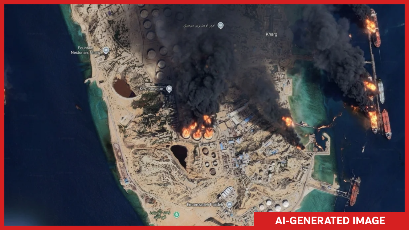
Google’s AI-Generated Satellite Image Tool Sparks Controversy and Concern
The digital world was abuzz after Google launched and then quickly retracted a new feature on Google Earth that allowed users to create AI-generated satellite images. This brief rollout, designed to fuel creativity, raised significant concerns about the potential for misinformation and manipulation.
Google initially introduced the tool as a way for users to blend imagination with reality, enabling them to generate satellite imagery by simply typing in a desired scenario. However, just a day after its debut, Google decided to remove the feature. In a statement on X, the company acknowledged the dual-edged nature of the tool, citing its use for beneficial purposes alongside misuse that breached their policies.
For those relying on satellite imagery to confirm events and investigate global incidents, the implications of such a tool were alarming. Henk van Ess, an open-source researcher, expressed his concerns to NPR, describing scenarios he tested with the tool, such as depicting a nuclear plant in Iran or refugee situations at the Mexican border. None were flagged, highlighting the risk of creating deepfake images at scale.
NPR demonstrated the tool’s capabilities by generating false images of Iran’s Kharg Island ablaze and a flooded U.S. Capitol, showcasing the ease with which major fake news events could be fabricated. The potential for abuse raised questions among journalists and analysts, with visual forensics investigator Evan Hill commenting on the boundless opportunities for misuse in a tweet.
Verifying Reality Amidst Digital Illusions
Satellite imagery has been a cornerstone in distinguishing reality from fabrication in an increasingly digital world. It provides a reliable source for verifying events, often being the go-to tool for open-source investigators. Although Google Earth images are not always the latest, their comprehensive coverage offers crucial reference points.
Jake Godin, a senior researcher with Bellingcat, emphasized the difficulty in faking satellite images, noting that their authenticity has been a “safe bet” due to their controlled nature and source. However, the emergence of tools for creating AI-generated imagery threatens to undermine this trust.
Challenges of Fake Satellite Images
Instances of fake satellite imagery have already appeared, such as during the U.S.-Israel conflict with Iran, where bogus images of a damaged U.S. base circulated. These images, likely generated with Google Earth and AI, were eventually debunked with real satellite photos.
Godin warned that the ability to produce AI-generated satellite images with ease could lead to a rapid increase in misinformation. He highlighted how false information tends to spread faster than corrections, potentially leading to governments disputing legitimate satellite data.
Google addressed these concerns by asserting their commitment to tackling misinformation. They assured users that images generated by the tool carry a SynthID watermark, identifying them as AI-generated. However, the open-source community remains skeptical about these measures, fearing the tool’s misuse could compromise the integrity of platforms like Google Earth.
This article was originally written by www.npr.org